


WEATHERSFIELD TWP A Voting District, Trumbull County, Ohio
About
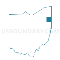
Outline

Summary
| Unique Area Identifier | 652560 |
| Name | WEATHERSFIELD TWP A Voting District |
| County | Trumbull County |
| State | Ohio |
| Area (square miles) | 2.82 |
| Land Area (square miles) | 2.77 |
| Water Area (square miles) | 0.05 |
| % of Land Area | 98.30 |
| % of Water Area | 1.70 |
| Latitude of the Internal Point | 41.19610690 |
| Longtitude of the Internal Point | -80.79661800 |
Maps


Graphs
Select a template below for downloading or customizing gragh for WEATHERSFIELD TWP A Voting District, Trumbull County, Ohio


Neighbors
Neighoring Voting District (by Name) Neighboring Voting District on the Map
- HOWLAND TWP B Voting District, Trumbull County, OH
- HOWLAND TWP L Voting District, Trumbull County, OH
- LORDSTOWN VILLAGE B Voting District, Trumbull County, OH
- NILES CITY 1A Voting District, Trumbull County, OH
- NILES CITY 1B Voting District, Trumbull County, OH
- NILES CITY 4D Voting District, Trumbull County, OH
- NILES CITY 4E Voting District, Trumbull County, OH
- NILES CITY 4F Voting District, Trumbull County, OH
- WARREN TWP D Voting District, Trumbull County, OH
- WEATHERSFIELD TWP K Voting District, Trumbull County, OH
Top 10 Neighboring County Subdivision (by Population) Neighboring County Subdivision on the Map
- Weathersfield township, Trumbull County, OH (25,908)
- Howland township, Trumbull County, OH (19,106)
- Warren township, Trumbull County, OH (5,551)
- Lordstown village, Trumbull County, OH (3,417)
Top 10 Neighboring Place (by Population) Neighboring Place on the Map
Top 10 Neighboring Unified School District (by Population) Neighboring Unified School District on the Map
- Warren City School District, OH (37,293)
- Howland Local School District, OH (22,449)
- Niles City School District, OH (19,217)
- Weathersfield Local School District, OH (5,583)
- Lordstown Local School District, OH (3,417)
Top 10 Neighboring State Legislative District Lower Chamber (by Population) Neighboring State Legislative District Lower Chamber on the Map
Top 10 Neighboring State Legislative District Upper Chamber (by Population) Neighboring State Legislative District Upper Chamber on the Map
Top 10 Neighboring 111th Congressional District (by Population) Neighboring 111th Congressional District on the Map
Top 10 Neighboring Census Tract (by Population) Neighboring Census Tract on the Map
- Census Tract 9216, Trumbull County, OH (4,248)
- Census Tract 9206, Trumbull County, OH (3,745)
- Census Tract 9328.02, Trumbull County, OH (3,647)
- Census Tract 9334, Trumbull County, OH (3,417)
- Census Tract 9328.01, Trumbull County, OH (3,029)
- Census Tract 9333.01, Trumbull County, OH (2,616)
- Census Tract 9205, Trumbull County, OH (956)